“Settlers are not born. They are made in the dispossessing, a ceaseless obligation that has to be maintained across the generations if the Natives are not to come back.” — Patrick Wolfe.[1]
In this post, I examine how American colonists became settlers through the process of invoking their perceived sovereignty to dispossess the Indigenous population and claim rights to land in Kentucky and the Ohio River Valley. In the North American British colonies, settlers moving west across the Proclamation Line of 1763 onto Native American lands necessitated the Treaty of Fort Stanwix of 1768 (as well as subsequent treaties) and increased tensions between American colonists, Indigenous communities, and the British imperial administration. American desires for land both prompted rebellion from their own sovereign and motivated the newly forming United States to become a settler colonial state in its own right.
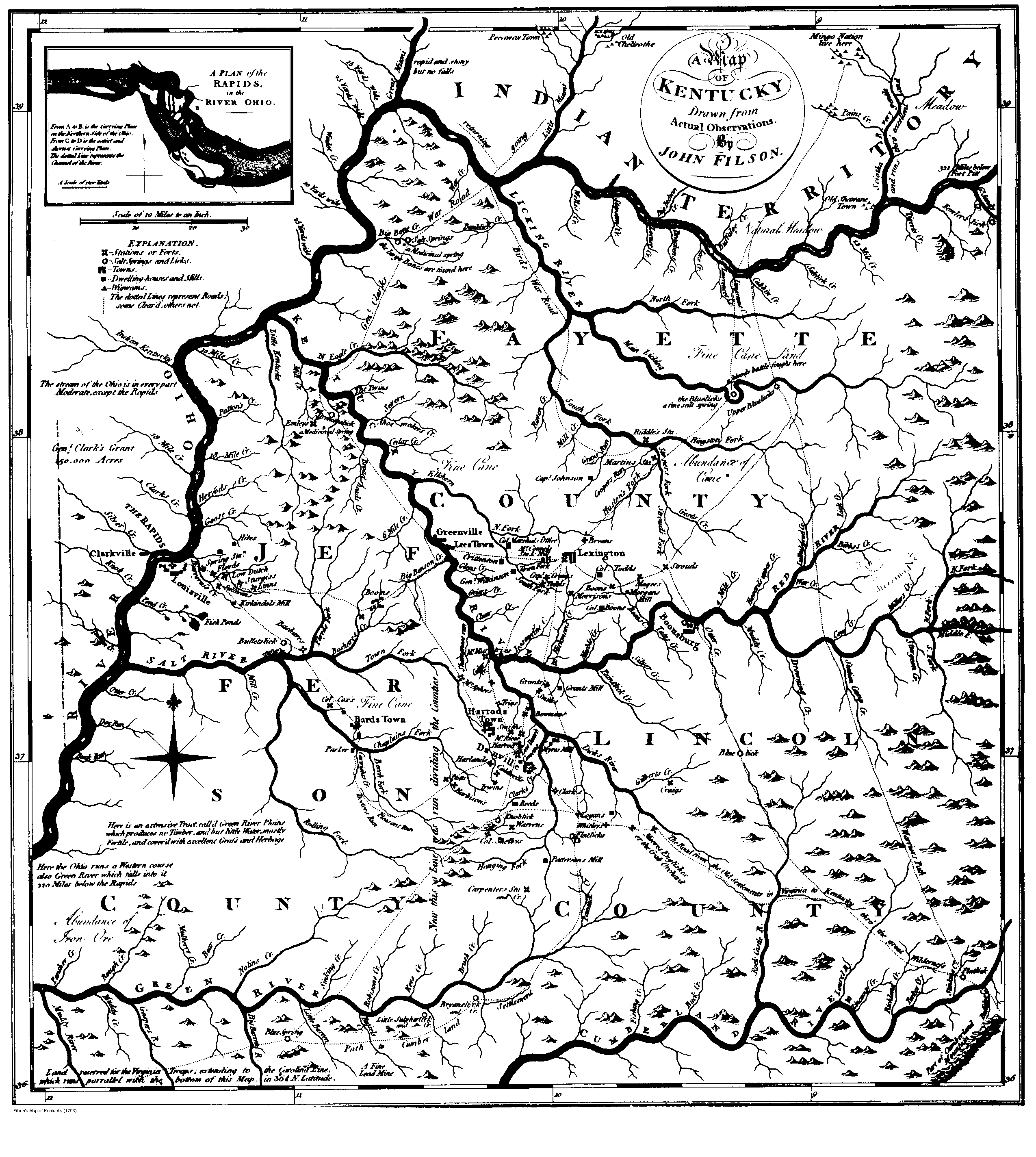
The American exploration of Kentucky (which contemporaries also referred to as Kentucke) began in 1767 when John Finley, a trader from North Carolina, and others traveled through the territory. Two decades later, contemporary historian John Filson, described Kentucky as the “Dark and Bloody Ground,” or “Middle Ground” due to the violence that erupted over its possession.[2] After conflict arose between the Anglo-American traders and their Native trading partners, the American colonists were forced to return home. Upon arriving at his homestead in North Carolina, Finley relayed his discovery of the Kentucky territory to Daniel Boone, a veteran of the French and Indian War (1754-1763), militiaman, frontiersman, and explorer. Boone later set out with other adventurers to explore the Kentucky territory in 1769. Despite the deaths of his companions due to illness and Native American attacks, Boone remained in the region until 1771. Filson observed that at about the same time:
Kentucke had drawn the attention of several gentlemen. Doctor Walker of Virginia, with a number more, made a tour westward for discoveries, endeavoring to find the Ohio river; and afterwards he and General Lewis, at Fort Stanwix, purchased from the Five Nations of Indians, the lands lying on the north side of [the] Kentucke [River]. Col. Donaldson, of Virginia, being employed by the State to run a line from six miles above the Long Island, on Holstein, to the mouth of the great Kenhawa [River], and finding thereby that an extensive tract of excellent country would be cut off to the Indians, was solicited, by the inhabitants of Clench and Holstein, to purchase the lands lying on the north side of the Kentucke river from the Five Nations. … [3]
While the language of “purchasing” lands from the Native inhabitants would seem to imply a recognition of Indigenous land rights and sovereignty, the purchases were no more than a gloss of legitimacy to cover the questionable means used to secure Native land for American settlement. Often, Americans treated with Native leaders who had no claim to the lands they sold to speculators. In the Treaty of Fort Stanwix, for example, the Six Nations (Iroquois Confederacy) sold lands that included Shawnee and Delaware territory to the Anglo-Americans without the consent of these tribes. Consequently, these communities were outraged when Americans began settling on their hunting grounds, claiming they had a right to be there. The appearance of a legitimate sale was enough justification for the settlers who moved onto Shawnee and Delaware lands. Not only did the sale validate their claim to land rights, but it also affirmed (in settlers’ eyes, at least) their sovereignty. Settlers encroaching on Indigenous lands viewed their reprisals as grounds for attacks on Native communities. Settler counter-attacks were often unsanctioned by the government but conveniently presented opportunities to compel greater land cessions, as happened in Lord Dunmore’s War in 1774 and the subsequent Shawnee land cessions.
Lord Dunmore’s War: The Battle for the Ohio Valley Begins
In January 1773, Virginia surveyor George Rogers Clark wrote to his brother to inform him of the land he had claimed in the region southwest of Fort Pitt and its prospects. The country “setels very fast” and people had already claimed lands down to the Scioto River 366 miles below Fort Pitt, Clark reported. As his survey partner, Roy observed earlier, the land was valuable, and Clark had already received “an offer of a very considerable sum” for his place. Even his surveying endeavors in the region were lucrative.[4] Americans could not wait to get their hands on the fertile Bottomlands along the Ohio River and its valley. Increasing settlement in the western regions of Pennsylvania and Virginia colonies brought more Americans into contact with Native inhabitants. Tensions grew as settlers continued encroaching on Native lands, initiating violence out of fear and growing racialized hostility.[5]
When Virginia surveyors began moving into Kentucky in 1773 and 1774, the Shawnee chiefs admonished the British that they could not be held responsible for what their young men might do when they met the white surveyors on their hunting grounds. Despite the warnings, the surveyors continued their exploration and their plans for settlement, as Clark recounted: “The country was explored in 1773. A resolution was formed to make a settlement the spring following, and the mouth of the Little Kenaway [Little Kanawha River] was appointed the place of general rendezvous in order to descend the river from thence in a body.”[6] Despite rumors of Indian attacks, Clark described “the whole party [as] enrolled and determined to execute their project of forming a settlement in Kentucky.”[7] However, not a single American discussed these plans with neighboring tribes, believing that the Treaty of Fort Stanwix (1768) granted them rights to these lands. Only the Six Nations were signatories, however, and as the Shawnee warnings demonstrate, other nations affected by the treaty protested its injustice. Resisting the Iroquois and American imposition of land cessions, the Cherokee even forced American surveyors to relocate the boundary initially set in the treaty to one Cherokee tribal leaders agreed upon.
From late 1773 through early 1774, Captain William Russell, an early Kentucky settler and part of Daniel Boone’s original entourage, sent out scouts to define this line between the Americans and Cherokee. He instructed that they should first figure out what the Indians’ intentions were. If they were for war, he admonished them to give him the “most speedy Acct thereof.” If they made no such discovery, they were to “find the boundary Line between us and the Cherrokees.”[8] While surveying, capture was entirely possible, a fate Russell was all too aware of, having lost a brother to an Indian attack several years before. Acknowledging this possibility, Captain Russell warned the surveyors to
avoid acting toward [the Indians] in a Hostile manner; unless in cases of the last extremity; because the least Hostility committed by You, at this Time when the Indians appear ripe for War; [would] not only blast our fairest hopes of Settleing [sic] the Ohio Country; and be Attended with a train of Concomitant Evils; but doubtless, involved the Government in a Bloddy [sic] War.[9]
The captain rightfully worried that Americans’ irresponsible, violent actions might stir up a war and impede settlement plans. In fact, his words foreshadowed precisely what he feared.
In April 1774, the threat of Indigenous attacks prompted Lord Dunmore, British Governor of Virginia, to issue a proclamation calling upon the Virginia militia to protect Kentucky settlers against Native raids on the interlopers. His statement also asks the militia to protect settlers’ right to the land which they claimed:
[The] settlement is in danger of annoyance from the Indians also; and it being necessary to support the dignity of his Majesty’s Government, and protect his subjects in the peaceable enjoyment of their rights, I … order and require the officers of the militia in that district, to embody a sufficient number of men to repel any insult whatever…[10]
At about the same time, Dr. John Connolly, who had declared Pittsburg to be under Virginia’s jurisdiction and protection, sent a letter to Captain Michael Cresap
letting us know that a war was to be apprehended and requesting that we would keep our position for a few days, as messages had been sent to the Indians, and a few days would determine the doubt. The answer he got was that we had no inclination to quit our quarters for some time. That during our stay we should be careful that the enemy should not harass the neighborhood that we lay in. But before this answer could reach Pittsburg, he sent a second express, addressed to Capt. Cresap, as the most influential man among us, informing him that the message had returned from the Indians that war was inevitable, and begging him to use his influence with the party to get them to cover the country by scouts until the inhabitants could fortify themselves. The reception of this letter was the epoch of open hostilities with the Indians.[11]
Two days later, on April 27, Captain Cresap’s force pre-emptively attacked a small band of Shawnee at Pipe Creek, killing and scalping one and incurring one significant injury among themselves. Several days after that, a number of Cresap’s force led by a man named Greathhouse murdered a group of innocent Mingo, including members of Mingo War Chief Logan’s family at Yellow Creek, launching events that would lead to the outbreak of Lord Dunmore’s War.
Some scholars maintain that Lord Dunmore and John Connolly intentionally planned the massacre to incite an Indian war in the Ohio Valley and open up more land for settlement. While wars between Anglo-American colonists and Native Americans offered a pretext for the colonists to punitively expropriate more land in the peace negotiations that followed the battle, the evidence does not suggest that Lord Dunmore and Connolly intentionally coordinated settler attacks to instigate a conflict for this purpose.[12] However, though they may not have masterminded the attack against Logan’s family, their actions set the stage for, and took advantage of, the violence that ensued. Dunmore called up the militia and Connolly set American nerves on edge with rumors of Indians on the warpath. Sources on the ground, including Captain Russell and his scouts, made clear that while Indian communities were watchful, there were no plans in place to launch attacks against the American settlements. At the same time, Captain Russell alluded to the possibility that one act of violence against the Indians could ignite a war. The atmosphere was ripe for violence, and Lord Dunmore and Dr. Connolly took advantage of it, knowing a war might give them the grounds necessary to “terminate the presence of [the Shawnee and Delaware] in Kentucky and western Pennsylvania.”[13]
Pennsylvania newspapers and correspondence from the contested lands reported the results of Shawnee and Mingo retaliations against the settlers:
-
May 30, 1774: “The Shawnese have raised 20 warriors to strike the Virginians, who sat off last Monday. I fear all the traders are killed at the Shawnese towns, as there was a party of Mingoes gathered for that purpose.”[14]
-
June 12, 1774: “We have great reason to be no longer in suspense concerning a war with the Indians, as they have already been guilty of several massacres; on Saturday, the 4th inst. were killed & scalped by them one Benjamin Spear, his wife & six children, on Duncard Creek; and the Monday following one Henry Wall, within sight of a fort that is built on Muddy Creek; one Keener, near the same place; and one Procter, near Grave Creek; there was also one Campbell, lately from Lancaster county, killed & scapled at New Comer’s -Town by the Mingoes.”[15]
-
June 22, 1774: “…When the News of the peoples being killed at Copper creek proved false several of the militia were assembled to go over there, and it was said they were sorry, exceedingly so, that it did prove false. So desirous are some of them for an Indian War; tho I can’t help fearing that it is the most worthless…”[16]
Events finally came to a head at the inaptly named Point Pleasant on October 10, 1774, where about 1000 militia had encamped several days before. Believing themselves safe and “a terror to the Indian Tribes on the Ohio,” the gathered forces of Shawnee, Mingo, and Delaware nearly caught them off guard.[17]
After hearing a good S[e]rmon Preached by the Rev. Mr. Terrey went to Repose [wit]h Our G[u]ards Properly Posted at a Distance from the camp as usual[,] little Expecting to be attack[e]d by any Party of Enemys as we looked upon them to be so much inferior to us in Number, but they taking the Advantage of the Night the[y] Crossed the Ohio on Rafts & [Posted] themselves Within one mile of our Camp where the[y] lay till morning[18]
However, a small hunting party discovered the Indians’ encampment before sunrise on the morning of October 10; one man was killed, but another escaped to warn the militia.
So fierce was the fighting that most accounts number the Native forces between 800 and 1000, but Captain John Floyd estimated their number to actually be closer to 500 based on the footprints left behind after the battle and the number of rafts reported on the river. Colonel William Christian arrived around midnight the night after the battle, collected stories from officers and militiamen and sent a report to Colonel William Preston, observing:
From what I can gather here I cannot describe the bravery of the enemy in the battle. It exceeded every mans expectations. They had men planted on each river to kill our men as they would swim over, making no doubt I think of gaining a complete victory. Those over the Ohio in the time of battle called to the men to ‘drive the white dogs in’. Their Chiefs ran continually along the line exhorting the men to ‘lye close’ and ‘shoot well,’ ‘fight and be strong.’ At first our men retreated a good ways and until new forces were sent out on which the enemy beat back slowly and killed and wounded our men at every advance Our people at last formed a line, so did the enemy, they made ma[n]y attempts to break our lines, at length our men made a stand, on which the enemy challenged them to come up and began to shoot. …Our men could have forced them away precipitately but not without great loss, and so concluded to maintain their ground all along the line. Which they did until Sundown, when the enemy were supposed to be all gone. Our people then moved backward, scalping the enemy and bringing in the dead and wounded…Late in the evening they called to our men that tomorrow they [would] have 2000 men for them, to fight on for they had 1100 men as well as them. They damn[e]d our men often for Sons-of-Bitches, said ‘Don’t you whistle now’ (deriding the fife) and made very merry about a treaty. [19]
Despite the displays of bravado, the allied Native forces retreated with as many of their dead and wounded as they could carry. They scalped or buried the rest of their dead compatriots on the battlefield, or threw them into the river to prevent them from falling into enemy hands. Then they disappeared into the night.[20]
Within a week of the Battle of Point Pleasant, Virginia’s colonial governor, Lord Dunmore reported that he had concluded a treaty with the Shawnee chief Cornstalk. With the combined might of his and Captain Lewis’ forces, Dunmore marched to the Shawnee villages on the Scioto. Through the machinations of British Indian agent, William Johnson, the Native confederacy that the Shawnee had orchestrated broke apart, leaving them alone and outnumbered. Faced with few alternatives, the Shawnee agreed to Dunmore’s peace terms and ceded their territory southeast of the Ohio River.[21]
By April 1775, George Rogers Clark reported to his brother that he had found employment as a Deputy Surveyor under Captain Hancock Lee. He was “to lay out Lands on [the] Kentuck for [the] Ohio Company at [the] rate of 80£ per year and [the] privilegde [sic] of Taking what Lands [he wanted].”[22] His missive of July 1775 is representative of many settlers’ response to the Kentucky territory. Clark observed, “a richer and more Beautifull Cuntry than this I believe has never been seen in America yet … I am Convinced that if [Father] once sees [the] Cuntry he never will rest untill he gets in it to live.”[23] Glowing reports of the beauty and fertility of the land encouraged increasing numbers of American colonists to cross the mountains and seek out their own piece of this land of opportunity. As they crossed the Cumberland Gap and claimed a plot of ground as their own, American colonists became complicit in Indigenous dispossession and were thenceforth transformed into settlers.
Conclusion
Following the Treaty of Fort Stanwix in 1768, the Shawnee, Delaware, and Cherokee protested the illegality of the Six Nations’ supposed sale of their lands. Their response indicates the heterogeneity of Native American tribes, which is important to keep in mind when contemporary Americans lumped all Indigenous peoples together under the misnomer, “Indian”. It also reveals the divisive and competitive nature of land cessions among Native communities as each jostled for greater protections of their own homelands at the expense of others’ through the early 1770s. (As the threat became more widespread and it became apparent that none were safe from avaricious American speculators and squatter-settlers, Indigenous leaders began to seek a united Native front during and, especially, after the American Revolution.)
Heedless of the significance of Indigenous protestations, Anglo-American colonists moved onto Native lands between 1768 and 1774 using the Treaty of Fort Stanwix as a “legal” justification for their claims. Believing the treaty affirmed their sovereignty over the region south of the Ohio River and backed by Lord Dunmore, American militias formed to protect their claims against Native efforts to repossess their own lands. Over the course of these six years, Anglo-American colonists became American settlers through the process of dispossessing the Native communities of Kentucky and the Ohio River Valley territory.
Through this transformation, they acquired a distinct identity that scholars today can retrospectively define as “settlers,” but also one they themselves defined at the time. Their understanding of themselves as Americans and not as British colonists, did not come about until the British-instigated Indian raids of 1777 and 1778. Nevertheless, prior to 1777, they understood that crossing the Cumberland Gap and making homes in the backcountry distinguished them from their peers who remained on the eastern side of the Alleghenies. They were “frontiersmen” (and women) and “adventurers” who embraced a simpler life and established democratic forms of local government, policing, and justice as an expression of political ideals and as models for their eastern cousins. They were willing to risk everything, even their lives, and confront any obstacle, including competing Indigenous claims for the material wealth and security that the western lands promised.
In settlers’ minds, their hard work to build homes, break ground, and cultivate fields entitled them to the lands they claimed according to squatters’ rights. Ignoring the fact that the land they acquired was already carefully managed and therefore value-added, settlers maintained that their improvements validated their sovereignty. Their confrontations with Indigenous inhabitants proved their mettle, their worthiness to settle the land, from which grew the myths about the hardy, independent backwoodsmen whose interactions with the Native population transformed them into Americans, according to nineteenth-century historian Frederick Jackson Turner. However much or little these Americans resembled their Native neighbors, it was the act of continual dispossession that resulted in the transformation from British colonists to American settlers.
The veneer of legality that the Treaty of Fort Stanwix was believed to provide the expropriation of Indigenous lands falls apart under scrutiny. However, it created the myth of American land rights. That was enough to prompt adventurers, land speculators, and families in search of economic advancement to stake and defend their land claims. The Battle of Point Pleasant did not end the contest for the Ohio and, later, the Wabash River Valleys; it was the opening salvo. The Shawnee land cessions in 1774 allowed more settlers into Kentucky, enriched Virginia land speculators, and provided the British with a pretext to encourage their Native allies to attack the American frontiers during the Revolution.
NOTES:
[1] Patrick Wolfe, “The Settler Complex: An Introduction,” American Indian Culture and Research Journal 37, no. 2 (2013): 1.
[2] John Filson, The Discovery, Settlement, and Present State of Kentucke (Wilmington: James Adams, Printer, 1784), 7.
[3] Filson, 7-8.
[4] GRC to Jonathan Clark, Ohio River Grave Creek Township, 9 January 1773, in IHC VIII, 2
[5] Peter Silver, Our Savage Neighbors: How Indian War Transformed Early America (W.W. Norton & Co., 2007).
[6] George Rogers Clark to Samuel Brown, 17 June 1798, in IHC VIII, 5.
[7] Clark to Brown, 17 June 1798.
[8] Capt. William Russell to Scouts. No Date [1773 or early 1774]. Draper Mss. 3QQ18. In Reuben Gold Thwaites & Louise Phelps Kellogg, Documentary History of Dunmore’s War (Madison: Wisconsin Historical Society, 1905), 5.
[9] Capt Russell to Scouts, in Documentary History of Dunmore’s War, 6.
[10] American Archives, Fourth Series: Containing a Documentary History of the English Colonies in North America from the King’s Message to Parliament of March 7, 1774 to the Declaration of Independence by the United States, I, (Washington, D.C.: M. St. Clair Clarke and P. Force, 1837), 283.
[11] George Rogers Clark to Samuel Brown, 17 June 1798 in IHC VIII, 7.
[12] Anthony F.C. Wallace, Jefferson and the Indians: The Tragic Fate of the First Americans (Harvard University Press, 1999), 7; Thomas P. Abernethy, Western Lands and the American Revolution (New York: Russell & Russell, 1959, 113-115.
[13] Wallace, Jefferson and the Indians, 7.
[14] “Delawares Friendly, Shawnee on Warpath: Extract of a letter dated Pittsburg, May 30, [1774].” Printed in the Maryland Journal, Saturday, 18, June 1774, in Documentary History of Dunmore’s War, 28.
[15] Extract of a letter from Fort Pitt, 12 June 1774. Published in the Pennsylvania Gazette, 22 June 1774, in Documentary History of Dunmore’s War, 36.
[16] Col Wm Christian to Col Wm Preston. Dunkard Bottom, Wed morning 22 June 1774, in Documentary History of Dunmore’s War, 43.
[17] Captain William Ingles to Colonel William Preston, 14 October 1774, Point Pleasant, in Documentary History of Dunmore’s War, 258.
[18] Captain William Ingles to Colonel William Preston, 14 October 1774, Point Pleasant, in Documentary History of Dunmore’s War, 258.
[19] Col William Christian to Colonel William Preston, 15 October 1774, Point Pleasant, in Documentary History of Dunmore’s War, 264-5.
[20] Colonel William Fleming to William Bowyer, no date, in Documentary History of Dunmore’s War, 256-7; Captain William Ingles to Colonel William Preston, 14 October 1774, Point Pleasant, in Documentary History of Dunmore’s War, 259.
[21] Jack M. Sosin, “The British Indian Department and Dunmore’s War,” The Virginia Magazine of History and Biography 74, no. 1 (January 1966), 47.
[22] George Rogers Clark to Jonathan Clark, Stewards Crossing, 1 April 1775, in IHC VIII, 9.
[23] George Rogers Clark to Jonathan Clark, Lees Town, Kentucke, 6 July 1775, in IHC VIII, 9-10.